Introduction
Radar is an acronym for Radio Detection and Ranging. It is an electronic system used to detect, locate or measure the velocity of targets. It collects information about distant objects or targets by sending electromagnetic waves to them and thereafter analyzing reflected waves or the echo signals from the objects. Radar can detect static or mobile objects in various conditions such as darkness, rain, fog and snow. The frequencies used by radar lies in the upper UHF and microwave range.
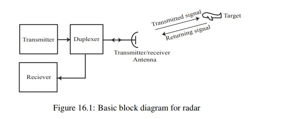
The basic principle of radar can be explained with the help of the block diagram as shown in figure 16.1. It consists of a transmitter and a receiver, each connected to a directional antenna. The transmitter generates high power modulated signal and transmits through the antenna. The duplexer allows the use of a single antenna for transmission and reception and also separates transmitter and receiver from each other. During transmission, the duplexer disconnects the receiver and connects the transmitter to the antenna.
The antenna radiates electromagnetic waves and these waves strike on a distant target which can reflect (echo) some of energy back to the same antenna. After transmission, the duplexer connects the antenna with the receiver and disconnects the transmitter. Then echo signals from the target are received by the receiver and processed to extract the required information. By noting the time taken for the signal to reach the target and echo signal to return back, the distance of the target can be calculated. The direction of the received echo signal gives an idea about the angular position of the target. It is also possible to detect the height, speed and direction of a moving target.
Radar equation
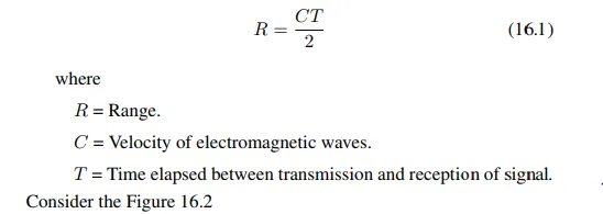
Basic radar range equations is given below.
Navigational aids and systems
Navigation is the process of finding and controlling the movement of a vehicle from one place to another. The position of an aircraft or ship can be found by using radio navigational aids. This is achieved by the installation of radio transmitters and receivers at known locations on the earth’s surface as well as at aircraft or ship which will work in conjunction with those on earth. Navigational aids include bouys, beacons, lightships, radio beacons, fog signals etc.
Navigational aids
· Bouys are floating objects anchored at bottom. Their shape and colour convey the message how to navigate around them.
· Beacons are structures permanently fixed to sea bed or land
Electronic navigation systems
· Instrument Landing System (ILS) Some applications related to remote sensing and military, aircrafts are controlled without pilots in it. ILS enables take off, flying and landing with the electronic systems on ground and air borne.
· Ground Controlled Approach (GCA) GCA is a system which assists the pilot to take off, fly and land the aircraft. This helps the pilot to land the aircraft even in hazardous atmospheric conditions such as fog, haze, snow, rain etc.
· Radio Direction Finder (RDF) RDF is used to find the direction of radio signal source. Direction of the electromagnetic signal is detected by the directional antenna. This over the horizon system helps the navigating ships.
· Long Range Navigation (LORAN) It is a terrestrial navigational system using low frequency radio transmitters that use the time interval between the radio signals.


Comments are closed.